|
|||
|
|
|
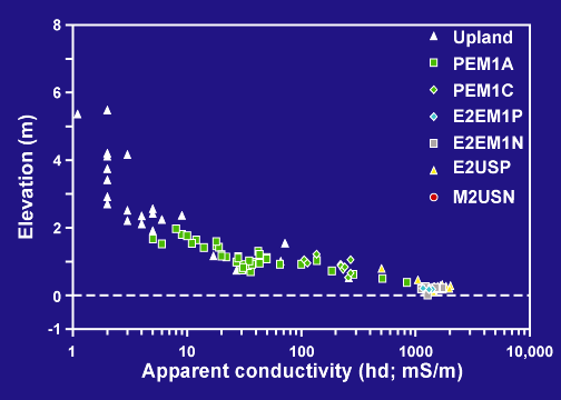
Elevation and Conductivity of NWI Units, MISP Transect |
 |
|
Elevation and apparent conductivity measured within 1992 National Wetland Inventory mapped units along the Mustang Island State Park transect. Elevations measured using an airborne lidar. Apparent conductivity measured using a ground-based Geonics EM38 ground conductivity meter in the horizontal dipole (hd) orientation. |