|
|||
|
|
|
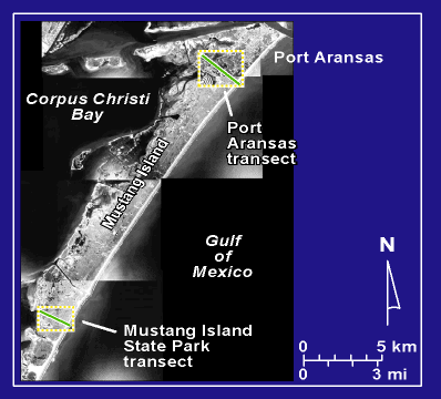
Mustang Island Photomap |
 |
|
Aerial photomosaic of Mustang Island showing locations of the Mustang Island State Park and Port Aransas transects. The photomosaic was compiled from aerial photographs flown in 1995 and obtained from the Texas Natural Resource Information System (TNRIS). |