|
|||
|
|
|
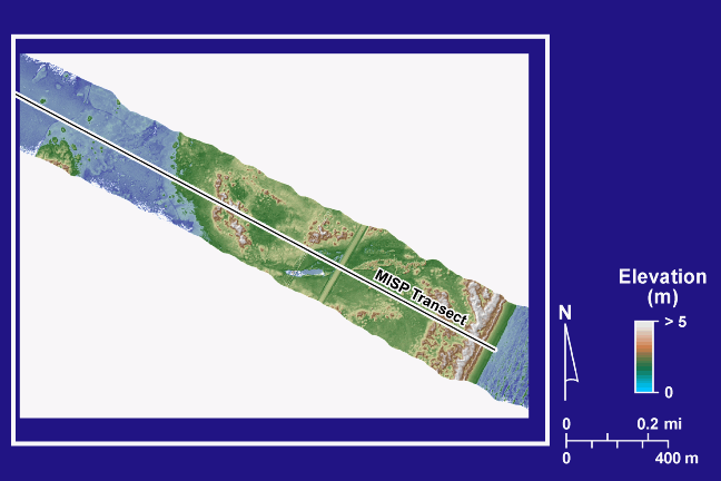
Lidar DEM, MISP Transect |
|
|
Digital elevation model (DEM) of the MISP transect. The DEM was constructed from lidar data acquired along the transect in 2003. |
|
|||||||
|
|||||||
|
|
|||||||
| Updated April 7, 2004 |